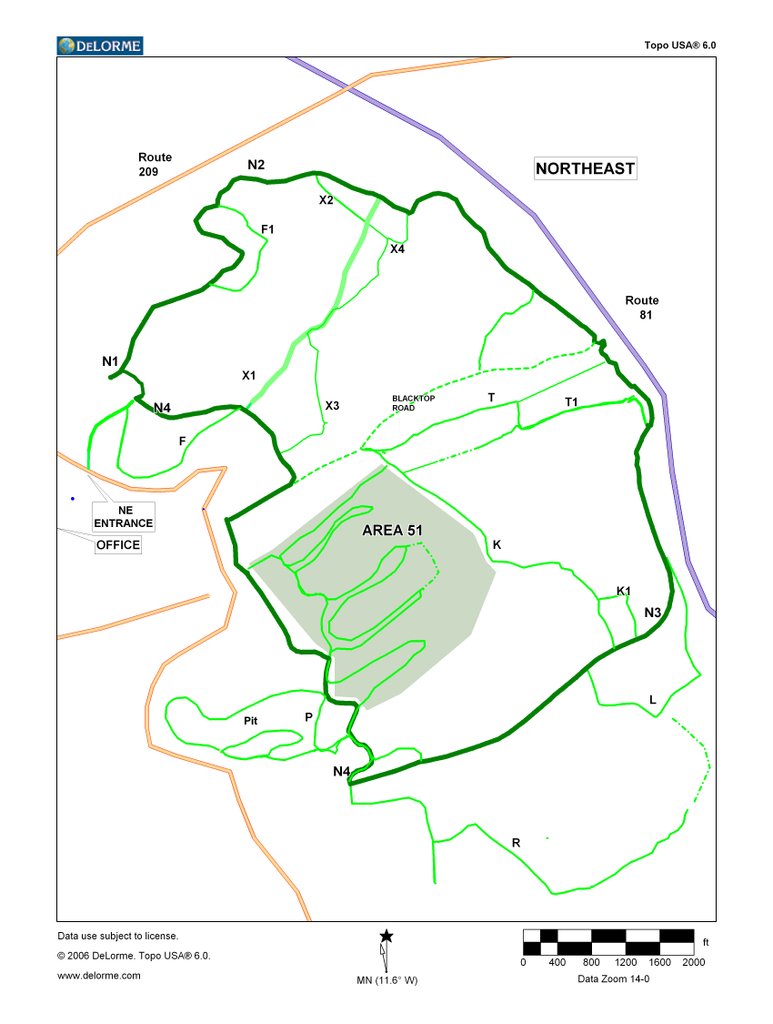
Before the snowmagedden of February slammed us with snow, I spent several days driving around the new Northeast property mapping out what trails are already there. Here is the result. It's very rough and will probably change every month for a while once we start widening some of the green trails and from there scouting and building new trails of all levels.
The main loop is called the "N" trail, with four separate sections to help identify where you are on the property. The area north of the Blacktop Road is wooded, the lower half has a mix of woods and wide open areas. The PIT area is just that, something similar to Lake Christy but without the super deep water. Area 51 is a huge wide open area where many of the clips from the RCQ and race events are from. Don't let the wide-open gaps on the map fool you, we've found some cool obstacles and areas for handcut trails all over the property. And there's a lot of elevation change all over the property as well.
All these green trails total about 14 miles. A few of them are easy, but most of them require low range.
Assuming no more snow and what we have melts enough, we're still on track to have all the trail signs up and letting park members wheel over there starting in April.
It's 1,250 acres, or roughly 4 times the size of our East property.

